Peer City Identification Tool Peer City Identification Tool
New tool helps communities find peer cities that
policymakers might learn from
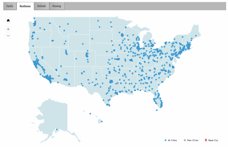
Peer cities are cities that are experiencing similar trends or challenges. Identifying a city's peers can give needed context to policymakers and practitioners. To identify peers, click on the map or enter a city name, select a theme, and scroll down to explore the results.
The Peer City Identification Tool (PCIT), developed by the Community Development and Policy Studies (CDPS) division of the Federal Reserve Bank of Chicago, is a data comparison and visualization instrument that can help policymakers and practitioners understand a municipality in the context of peer cities. Drawing on city-level indicators from the American Community Survey and historical Decennial Census records, the PCIT performs a cluster analysis to identify groups of similar cities along economic, demographic, social, and housing dimensions. The tool stems from the Industrial Cities Initiative (ICI), a study that profiled ten Midwestern cities with manufacturing legacies, describing how they have fared in socioeconomic terms over time. The PCIT-960 includes 960 places from around the United States that meet one of the following criteria - these places were incorporated, with at least 25,000 population by the 1960 census; or these places were incorporated, with at least 50,000 population by the 2010 census. All data and images can be exported, and the full underlying dataset of 960 cities and 28 indicators is available for download.
|
Land Use and Sustainability Webinar
City administrators showcase the integration of
planning and sustainability
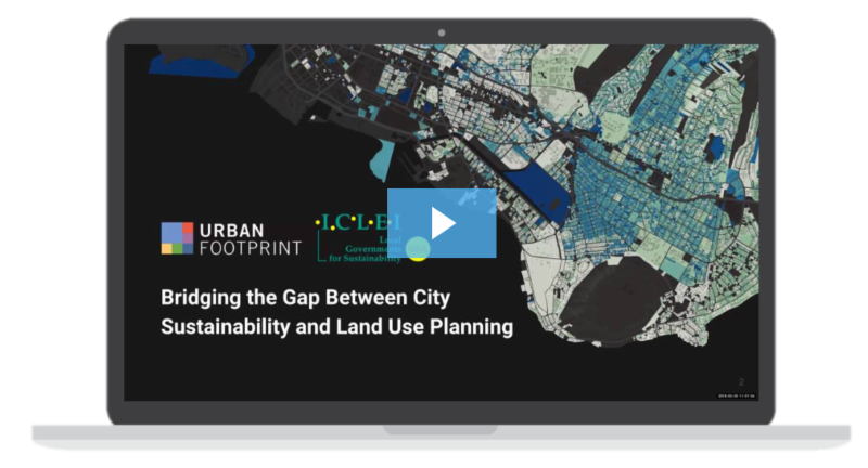
Urban Footprint sponsored a recent webinar: Bridging the Gap Between City Sustainability & Land Use Planning. The webinar provides guidance to planners and administrators on how to build data-driven climate action plans with UrbanFootprint and ICLEI.
UrbanFootprint, a Berkeley-based location intelligence and urban planning software company, today announced their partnership with ICLEI Local Governments for Sustainability USA, a global network of local governments committed to creating sustainable, equitable, and resilient communities.
In this webinar the City of Honolulu and the City of Madison will to explore how the UrbanFootprint and ICLEI partnership can help local governments align planning and greenhouse gas (GHG) management activities for better outcomes.
A recording of the webinar is available here.
|
Kane County Improves Health Ranking
Kane County was acknowledged as the 6th healthiest county in Illinois in a 2018 health rankings report
Kane County ranks as the 6th healthiest in Illinois, according to the annual County Health Rankings, released today by the Robert Wood Johnson Foundation (RWJF) and the University of Wisconsin Population Health Institute (UWPHI). The Rankings are available at www.countyhealthrankings.org. An easy-to-use snapshot that compares counties within states, the Rankings show that where you live influences how well and how long you live.
This year's ranking follows a trend of improvement over the last four years. Last year, Kane ranked 7th, in 2017, 12th, and in 2016, 13th.
|
Better Town Toolkit
A guide for designing better spaces in your community
This one-of-a-kind resource brings together practical design solutions for complete places, best-practice details and implementation tools.
Who is this website for?
This website is targeted first to citizen-planners and advocates who sit on local boards and commissions and to others who are advocates for good community design, sustainable economic development, and smart growth. The material also informs prospective developers on best practices. Professional planners can use this as a training tool in their client communities.
What is covered?
- Best practice town planning and design for each of six place types: downtowns, the edges of downtowns, corridors, crossroads, new neighborhoods and rural places.
- Transit-oriented development.
- Design details for nature, links and complete communities.
- How to implement best practices through planning, regulation and administration.
- How to match the toolbox to your local capacity.
Many of the case studies are derived from planning initiatives conducted throughout the New York metro region, but the planning principles and lessons are broadly applicable.
|
Energy Efficiency Resource Library
Online resource library by the City Energy Project features cities' energy efficiency best practices
The City Energy Project partnered with 20 cities and counties across the U.S. to create and implement customized, impactful energy efficiency policies and programs. The lessons learned, and best-in-class practices are now distilled into the City Energy Project Resource Library.
The library is a free, comprehensive online resource captures the best practices pioneered through the City Energy Project so that other cities can significantly boost energy efficiency in buildings. It pairs informed guides, tools, templates, and checklists with curated city-specific, real-world examples pulled from City Energy Project cities to help city sustainability offices, mayor's offices, and other local leaders customize their energy efficiency efforts for maximum return in their individual jurisdictions.
The library is organized into 4 separate resource categories:
- Understand Building Energy Use
- Reach Community Stakeholders
- Prioritize Policies and Programs
- Communicate Progress and Results
To explore the resource library categories, visit the City Energy Project website.
|
|